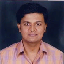
Ashoka Vanjare
Work place: Department of Aerospace Engineering, Indian Institute of Science, Bangalore, India
E-mail: ashokavanjare@gmail.com
Website:
Research Interests: Image Processing, Image Manipulation, 2D Computer Graphics, Computer Graphics and Visualization, Computer Vision
Biography
Ashoka Vanjare is a Project Assistant in the Department of Aerospace Engineering, at Indian Institute of Science, Bangalore, Karnataka India. His major research fields are Geographic information system, remote sensing, photogrammetry, image processing, Computer vision and Computer Graphics
Author Articles
Satellite Image Processing for Land Use and Land Cover Mapping
By Ashoka Vanjare S.N. Omkar J. Senthilnath
DOI: https://doi.org/10.5815/ijigsp.2014.10.03, Pub. Date: 8 Sep. 2014
In this paper, urban growth of Bangalore region is analyzed and discussed by using multi-temporal and multi-spectral Landsat satellite images. Urban growth analysis helps in understanding the change detection of Bangalore region. The change detection is studied over a period of 39 years and the region of interest covers an area of 2182 km2. The main cause for urban growth is the increase in population. In India, rapid urbanization is witnessed due to an increase in the population, continuous development has affected the existence of natural resources. Therefore observing and monitoring the natural resources (land use) plays an important role. To analyze changed detection, researcher’s use remote sensing data. Continuous use of remote sensing data helps researchers to analyze the change detection. The main objective of this study is to monitor land cover changes of Bangalore district which covers rural and urban regions using multi-temporal and multi-sensor Landsat - multi-spectral scanner (MSS), thematic mapper (TM), Enhanced Thematic mapper plus (ETM+) MSS, TM and ETM+ images captured in the years 1973, 1992, 1999, 2002, 2005, 2008 and 2011. Temporal changes were determined by using maximum likelihood classification method. The classification results contain four land cover classes namely, built-up, vegetation, water and barren land. The results indicate that the region is densely developed which has resulted in decrease of water and vegetation regions. The continuous transformation of barren land to built-up region has affected water and vegetation regions. Generally, from 1973 to 2011 the percentage of urban region has increased from 4.6% to 25.43%, mainly due to urbanization.
[...] Read more.Aerial Video Processing for Land Use and Land Cover Mapping
By Ashoka Vanjare S.N. Omkar Akhilesh Koul Devesh
DOI: https://doi.org/10.5815/ijigsp.2013.08.06, Pub. Date: 28 Jun. 2013
In this paper, we have proposed an Automatic Aerial Video Processing System for analyzing land surface features. Analysis of aerial video is done in three steps a) Image pre-processing b) Image registration and c) Image segmentation. Using the proposed system, we have identified Land features like Vegetation, Man-Made Structures and Barren Land. These features are identified and differentiated from each other to calculate their respective areas. Most important feature of this system is that it is an instantaneous video acquisition and processing system. In the first step, radial distortions of image are corrected using Fish-Eye correction algorithm. In the second step, the image features are matched and then images are stitched using Scale Invariant Feature Transform (SIFT) followed by Random Sample Consensus (RANSAC) algorithm. In the third step, the stitched images are segmented using Mean Shift Segmentation and different structures are identified using RGB model. Here we have used a hybrid system to identify Man-Made Structures using Fuzzy Edge Extraction along with Mean Shift segmentation. The results obtained are compared with the ground truth data, thus evaluating the performance of the system. The proposed system is implemented using Intel's OpenCV.
[...] Read more.Other Articles
Subscribe to receive issue release notifications and newsletters from MECS Press journals